Planning an adventure into the mountains requires a niche skillset that includes the ability to accurately research, route, and execute your plan of action safely and efficiently. Experienced expeditioners will tell you that getting to this point takes years of practice–at least, it used to, until the proliferation of the smartphone. There’s an app for everything nowadays, and that includes for planning your next high-altitude backcountry adventure. onX Maps helps users get out into nature better equipped with knowledge of weather, conditions, and the likelihood of traipsing unexpectedly onto private land..
onX uses your phone’s GPS location tracker to identify where you are and what is around you. The company launched its Hunt App in 2009, becoming the first mobile app to give hunters access to extensive digital maps of huntable lands across the US. The decade since has seen the company develop digital topographic maps of public and private land and its use for a variety of recreational activities and outdoor travel ranging from hiking to camping and, with the 2021 launch of onx Backcountry and the development of its “Snow” mode, even backcountry skiing.
“onX Backcountry is a multi-season and multi-activity app,” says Matt Maydick, the brand’s backcountry marketing manager. “While some apps begin with a blank topo(graphic map), our goal is to make this experience more immersive and intuitive. Our new Guidebook user experience is helping empower that experience – by outlining broad zones of interest, where there are a lot of backcountry lines in places like Colorado.”
Regular outdoorsmen may be familiar with the app’s premise, even if they haven’t used onX yet. In 2020, onX acquired Adventure Projects, the brand that built popular trail mapping apps including MTB Project, Mountain Project, and Trail Run Project, among others. This enhanced its portfolio of trail knowledge across the broad spectrum of outdoor recreation and brought millions of new users into its reach.
Users can hone in on an area and see all nearby trails and routes. They can then select one and see current conditions and any notes related to its use. And, the app allows users to draw and create their plans themselves, and then save or share them with others. This means one important thing for your outdoor adventures: it’s now easier than ever to get out on the trail safely, smartly, and confident that you’re about to have the best possible time.
Upping the Bar For Backcountry Routefinding
Credit: Tim Wenger
In winter, onx Backcountry’s best use case is for backcountry skiers and snowboarders. The app is up-to-date with snow stability conditions from avalanche.org and avalanche centers across the US and Canada. It’s effectively a smartphone-optimized trip report and route-finding tool updated daily with GPS-location tagging, so you can see the historical locations of where slides have happened and any fatalities that occurred.
By toggling the app to Snow mode, users can hone in on any specific mountain zone to see topographic maps displaying pertinent information like elevation, current weather, and potential hazards. In snow mode, a sidebar displays specific lines within the zones based on your location, with aspect and elevation information for route planning and direct comparison with the embedded latest avalanche report.
“Snow Mode is how we tailor our platform for powder seekers, giving them the tools and information that they need to make informed decisions and have an epic day out in the mountains,” Maydick says. “The user can then drill down in a zone, looking at the avalanche forecast, current and future weather reports, seeing the lines on map, and turning on route finding layers like Slope Aspect and Slope Angle.”
Credit: Tim Wenger
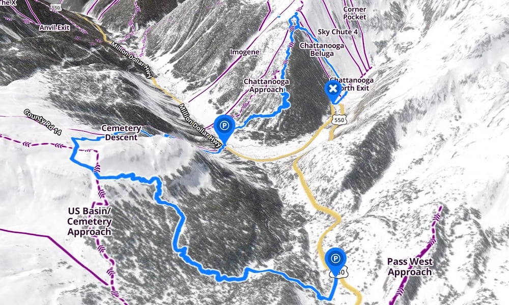
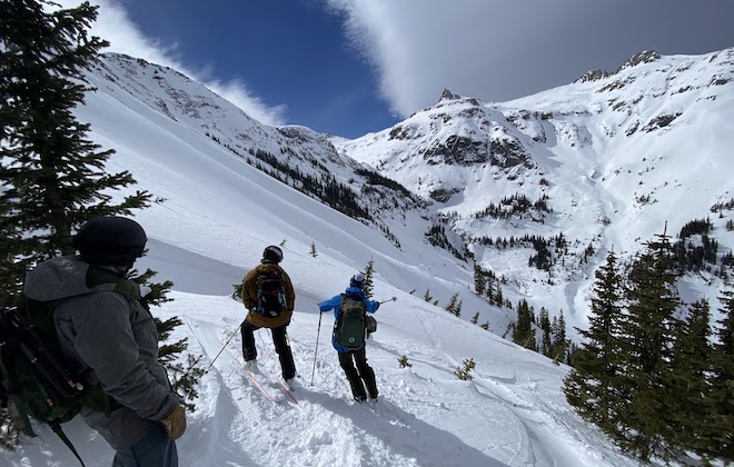
I recently used the app on a backcountry ski tour near Silverton, Colorado, and our group was able to build a multi-run ski day that avoided hazardous terrain while still allowing us to reach steep pitches. As seen in the above still-frame, our route is documented and tracked and nearby runs and their access points can be seen as well.
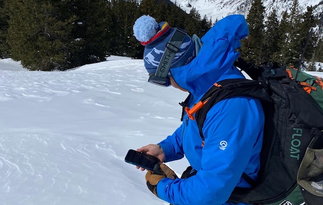
Identifying safe terrain and any hazards you may encounter has never been broken down so clearly, and optimized for mobile, to boot. During our tour, we received notifications for mining claims, private land, and other facets of backcountry use that users need to keep abreast of. Included in the Elite level prescription ($99.99), users can literally see who owns the land they are on, anywhere in the US. For the true nerds, this includes residential and commercial properties located not only in and around public land but in towns and cities as well – so if you’re curious whether your Airbnb is run by a local or a helicopter property management agency, just open the same app you used to plan your ski tour. If you aren’t as information hungry, the cheaper $29.99-per-year subscription includes the same avy reports and wayfinding references.
“Someone can go one step further and see route descriptions from experts, like accredited guides, and begin to plan their adventure,” Maydick says.
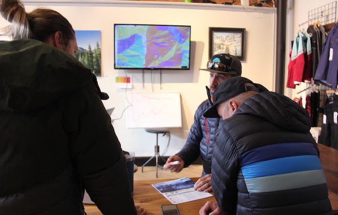
Our ski tour included runs taken from Backcountry Skiing in Silverton Colorado. The app can be accessed on desktop as well, which we used in our route planning by broadcasting the app to a large TV screen for everyone in the group to share input.
Executing an epic expedition
Credit: Tim Wenger
This is a lot to grasp, so let’s walk through an example scenario that could apply to both Snow mode or Trail mode. You and your crew are planning a full-day trip into the backcountry. The goal is to arrive at the trailhead early in the morning, mount up all your gear, and ascend 1,500 feet to a cabin atop a nearby peak. There, you’ll indulge in the gourmet lunch stowed securely in your pack, perhaps play a round Yahtzee over a summit beer, and then head back down to reach the car by sundown.
Your chosen cabin can be reached by any of three potential routes. One guy in the group, however, isn’t as proficient with steep inclines, so you want to know the easiest route to the cabin, even if that involves a few extra switchbacks.
Once you select the zone you plan to travel to in the onx Backcountry app, the app displays current trail information including conditions and parking. You can easily toggle to alternate routes. In winter, it also displays SNOTEL weather information, ideal for spring days when knowing whether or not the temperature dipped below zero overnight–and therefore whether or not the snow layers froze–greatly impacts the day’s decision-making.
Users can see the length of each potential route and how long it might take. Because it’s 2023, the app even allows users to text, email, or Airdrop a hyperlink directly to this information, so everyone in the party can be on the same page at the trailhead in the morning. Of course, tracking and saving of live location info is included alongside relevant stats like total vertical feet ascended and descended, and total mileage covered.
The result is a smoother planning process that leads to a better day in the field. As experienced expeditioners would surely agree, smooth planning leads to more enjoyable travels. That’s an adventure trip worth taking.