
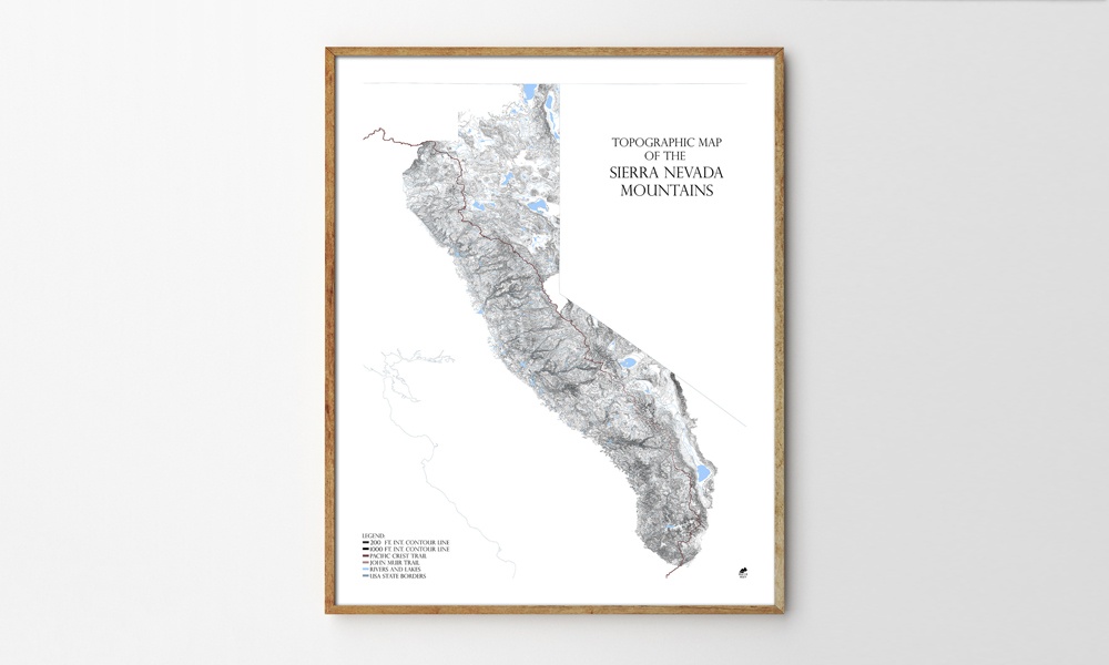
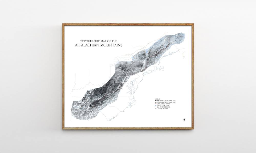
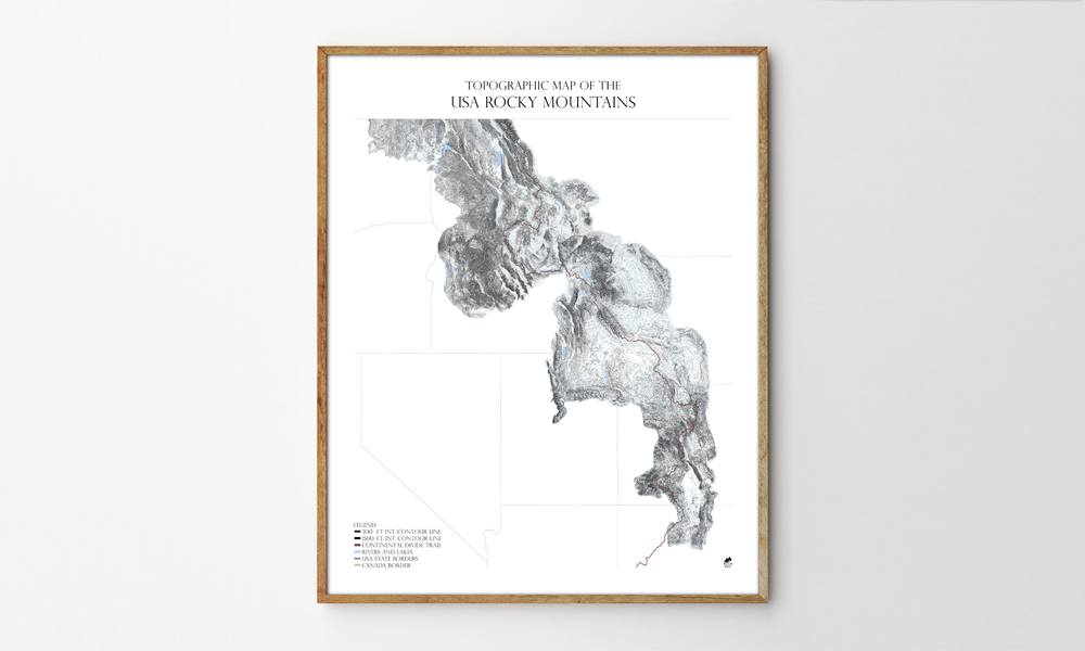
Muir Way, makers of the National Park Maps and Topographic Ski and Snowboard Mountain Maps, is back with a new line of topographic maps dubbed the Range Series. By combining the data from hundreds of smaller USGS quadrant maps and illustrating them with contour lines, Muir Way has created topographic maps of the Appalachian Mountains, Rocky Mountains and Sierra Nevada Mountains that are more detailed and accurate than anything else we’ve seen. As each of the pieces in the Range Series deals with the maps as art pieces, man-made elements like roads, cities or towns have been removed to focus on the natural features that make up each mountain range.
Muir Way Range Series Topographic Maps
More Home

Home
The Rug That Really Tied the Room Together Is Headed to Auction—And I Spoke With the Man Who Saved It
Nearly 30 years after The Big Lebowski, the film's rug is up for grabs.

Home
Our Favorite Finds From Bespoke Post’s Fourth of July Sale
Up to 50% off. These are the pieces we'd grab before they're gone.

Home
Black Book: 13 Products Our Editors Loved in June 2026
The products our editors have been obsessed with in June 2026.
-
Home
The Rug That Really Tied the Room Together Is Headed to Auction—And I Spoke With the Man Who Saved It
Nearly 30 years after The Big Lebowski, the film's rug is up for grabs.
-
Home
Our Favorite Finds From Bespoke Post’s Fourth of July Sale
Up to 50% off. These are the pieces we'd grab before they're gone.
-
Home
Black Book: 13 Products Our Editors Loved in June 2026
The products our editors have been obsessed with in June 2026.